

🤕 Existing workflows are sometimes painfully imperfect:
- Even experts often struggle
- Linked visualizations are difficult to build
- Friction when visualizing from a programming environment
Exploring more approachable geospatial data workflows as a community

🧑🤝🧑 Community engagement stuff
👐 Open source stuff
💪 Accessibility stuff (earthaccess)
📦 New Python project/environment management tools (uv, pixi)
☕ JavaScript map engines & cloud-native data support
🕳️ What gaps or friction you see in the open source geospatial ecosystem
🧩 Do you have a project that you feel fits in this community?
🛑 What’s stopping your team from trying JupyterGIS?
You got your chocolate in my peanut butter!
GeoJupyter is not software; it’s a community which will build many things!
When our community burned, where was the satellite information?

…we are failing the people and causes that need us the most.
– Brianna Pagán, Technical Program Lead @ Development Seed, ex-NASA Deputy DAAC Manager
🧮 Do some analysis
💾 Write out a data file
📥 Download it to local machine
🗺️ “Bounce” to QGIS, load basemap, load data file
👀 Validate, inspect, explore
🚿 “Bounce” back to Notebook and repeat

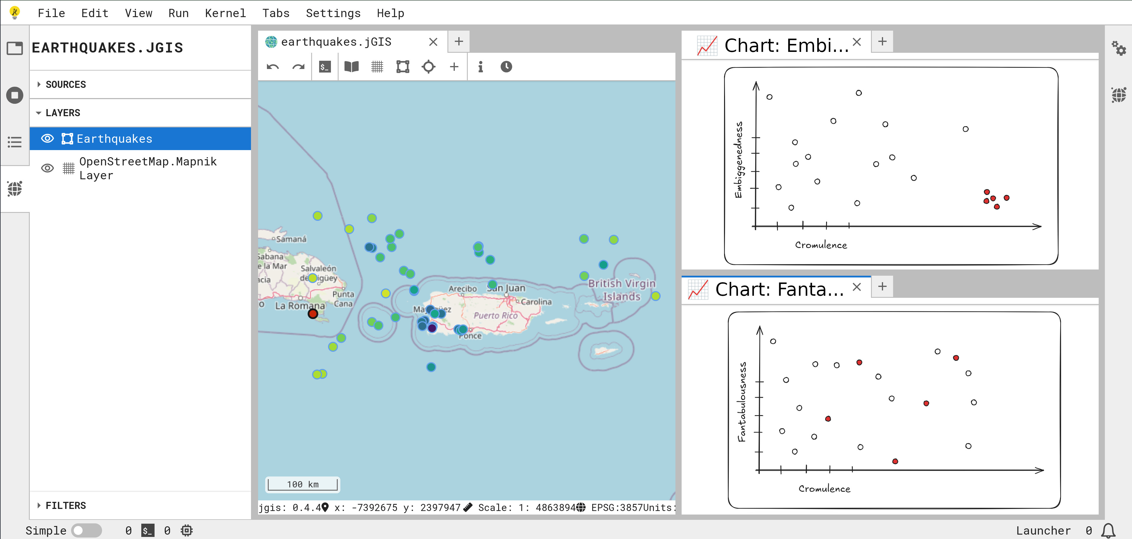
‼️ Early development ‼️
![]()
🧑🤝🧑 Community engagement stuff
👐 Open source stuff
💪 Accessibility stuff (earthaccess)
📦 New Python project/environment management tools (uv, pixi)
☕ JavaScript map engines & cloud-native data support
🕳️ What gaps or friction you see in the open source geospatial ecosystem
🧩 Do you have a project that you feel fits in this community?
🛑 What’s stopping your team from trying JupyterGIS?